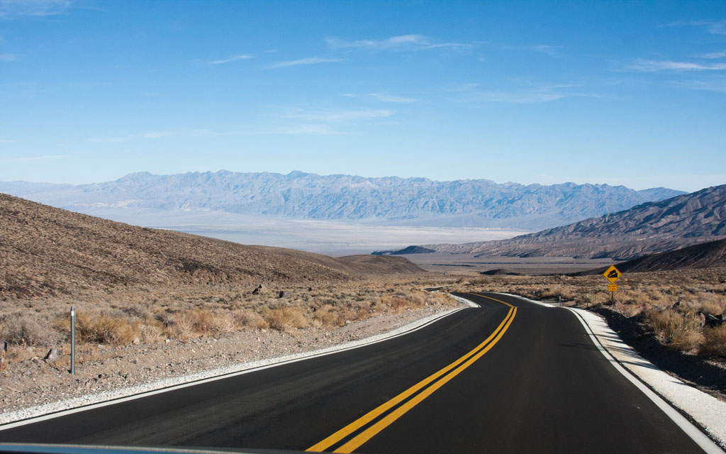
The map to the right is part of Death Valley. Death Valley National Park is the largest national park in the Lower 48 and thus this is only a partial map. Death Valley is 140 miles long and 5 to 15 miles wide or about 3,000 square miles. It contains some of North America's most inhospitable terrain, with extreme heat that has left this desert area strangely beautiful. The extremes of Death Valley are impressive:
To avoid the extreme heat of Death Valley we decided to visited in mid-December, very comfortable and not too crowded. Our short 3 day visit is detailed below with references to the different letters on this map.
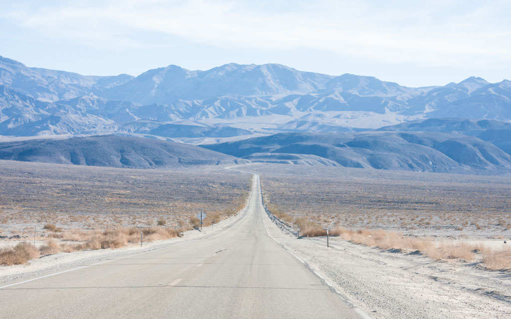 Day #1=>We entered Death Valley from the west on highway 190 through Stovepipe Wells Gate, point "A" on the map.
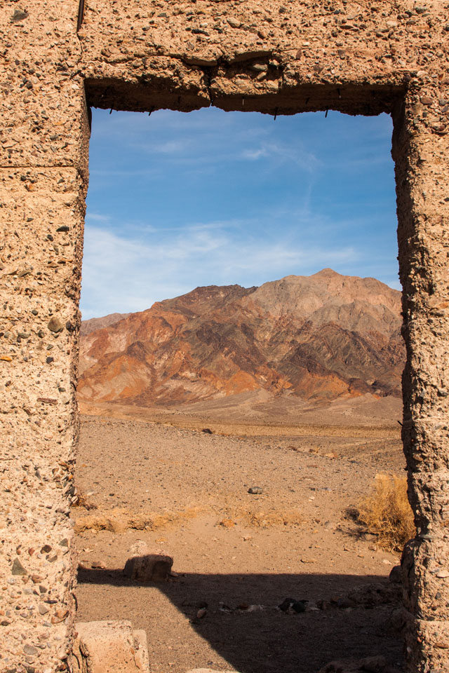
After paying our park fee we proceed north up the valley to Titus Canyon, point "D" on the map. The Titus Canyon Road is a 26 mile, one-way 4x4 trail, starting from highway 374, near Beatty, NV. Point "D" on the map is a common spot to park and hike in a short distance to get an idea of how difficult it would be to drive. This west side of Titus Canyon is a narrow road snaking through steep canyons. The road looked fun but after talking to other tourist who had driven it we decided to pospone until we had better tires.
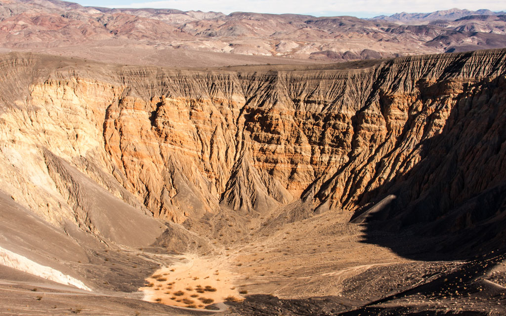 Next we headed farther north to Ubehebe (pronounced you-bee-HEE-bee) Craters, point "B" on the map. The craters in this area of Death Valley are estimated to be from 2,000 to 7,000 years old. There are a number of hiking opportunies at this stop. The largest crater is 1/2 a mile across so there are a number of rim hikes or hike down into the 600 foot crater. Although a word of warning, hiking back up is soft sand and is thus much harder than it looks.
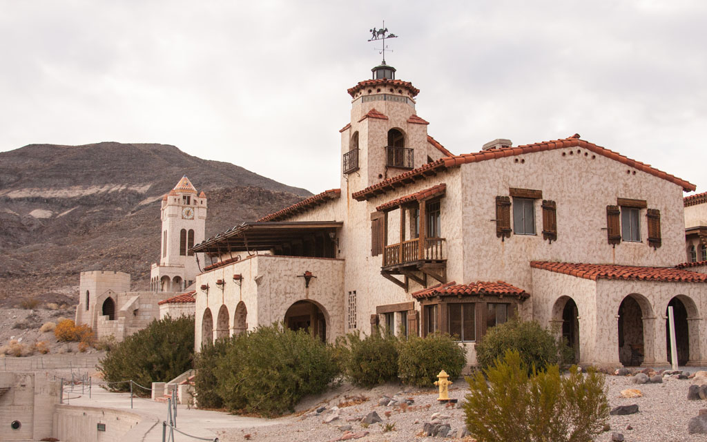
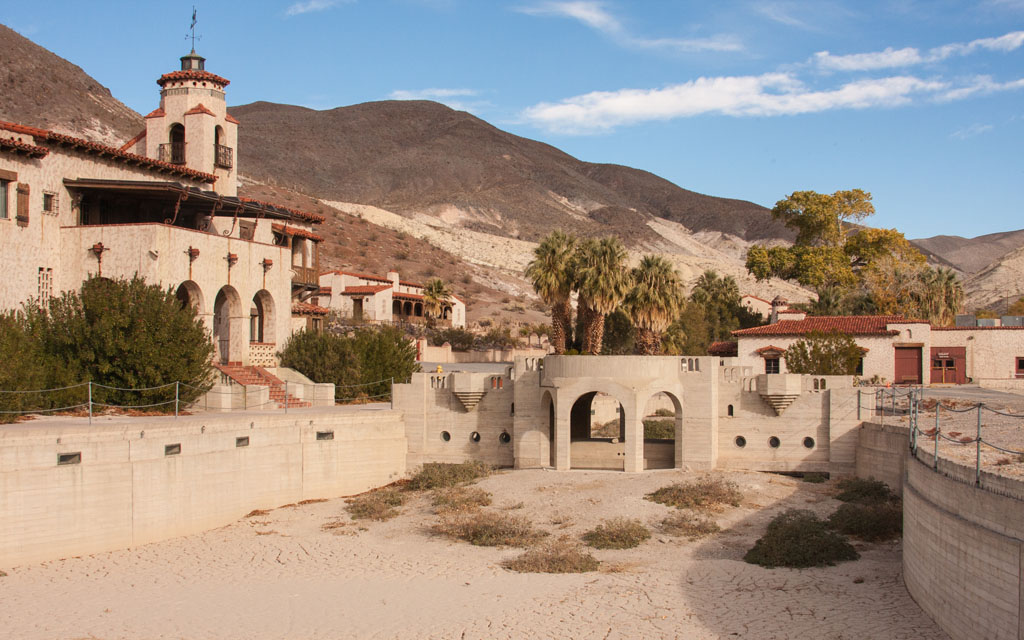 In the winter the days are short so our last activity for day-1 was Scotty's Castle, point "C" on the map. Scotty's Castle was the highlight of Death Valley for us. Unfortunately the castle was severly damaged in 2015 when a storm stalled right over the castle. The storm actually hit Death Valley twice. After regaining strength over the Pacific the 2nd hit was a direct hit on Scotty's Castle. The storm was classified as a 1,000 year storm. After the storm tours of the castle were suspended for a long time until they finally got approval to give Sunday only tours, during reconstruction. Our tour was great. During the tour we would told the Sunday tours will stop in April 2019 and normal tours are not expected until late 2020. The story of Scotty, a con-artist and the Johnsons who built the castle is easily movie material...and true. And a fun fact, Betsy Johnson was from Walnut Creek, CA. Those who were luck enough to see Scotty's Castle before 2015 can definately see the damage when looking at these images. Cannot wait to return after restoration and see the difference. One thing the storm did do is fill the pool you see in the smaller image for the first and only time....and that tells you how much it rained...enough to fill a giant pool!!! Click here to see more of our Scotty's Castle images.
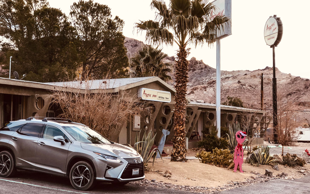 By the time the tour ended it was getting dark. We were only able to get two nights in Death Valley so this night we found a place in Beatty. So we headed south to Highway 374 and headed east into Nevada and to the town of Beatty, point "F" on the map. The biggie in Beatty was cheap gas at the casino, $2.99/gallon vs. $4.75/gallon in Death Valley.
The Atomic Inn was clean and did not hurt the budget. But that was not the issue of Beatty. The issue with Beatty was virtually no dinner options....the ultimate top was Denny's!!!!
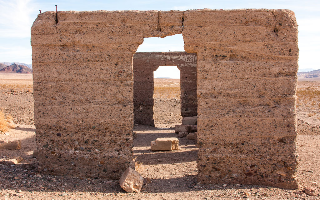
 Day #2=>On our 2nd day we headed back Highway 374 toward Death Valley. Before entering the park we did a short drive through of Rhyolite, a ghost town, point "G" on the map. Rhyolite was founded in 1904 and was dead by 1916, part of the late Gold Rush era. But at one time Rhyolite had a population of over 10,000.
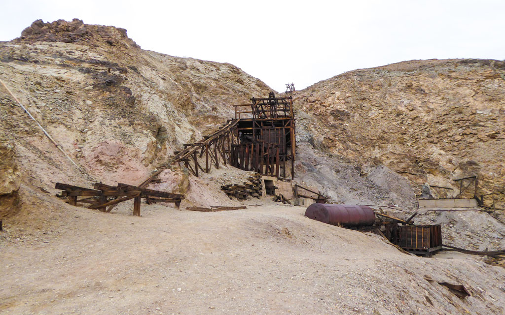
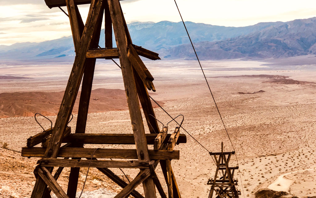
The morning light was not very good so we did not spend much time in this ghost town. We continued on Highway 374 and re-entered Death Valley through Hells Gate, point "H" on the map. We then turned left onto Beatty Junction which took use to the Keane Wonder Mine, point "I" on the map. This was another Death Valley highlight as visitors are allow access to virtually everything. This gold mine produced over a $1 million in gold before being shut down in 1912. They installed tramway cars that traveled a mile in the mountains and then 1,000 feet down. This engineering feat was able to move over 70 tons of ore per day out of this mine...amazing!!! Click here to see more of our Keane Wonder Mine images.
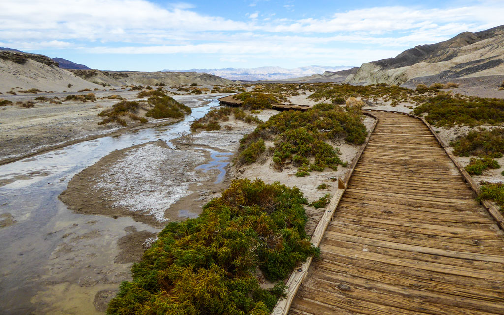
After the mine we continued down Beatty Junction until we reached the main north/south road, Highway 190 and turned right. Just a short backtrack to the Salt Creek trail, point "J" on the map. This is a 1 mile raised trial through the Salt Creek that is home to the pupfish and some of Death Valley's best birding.
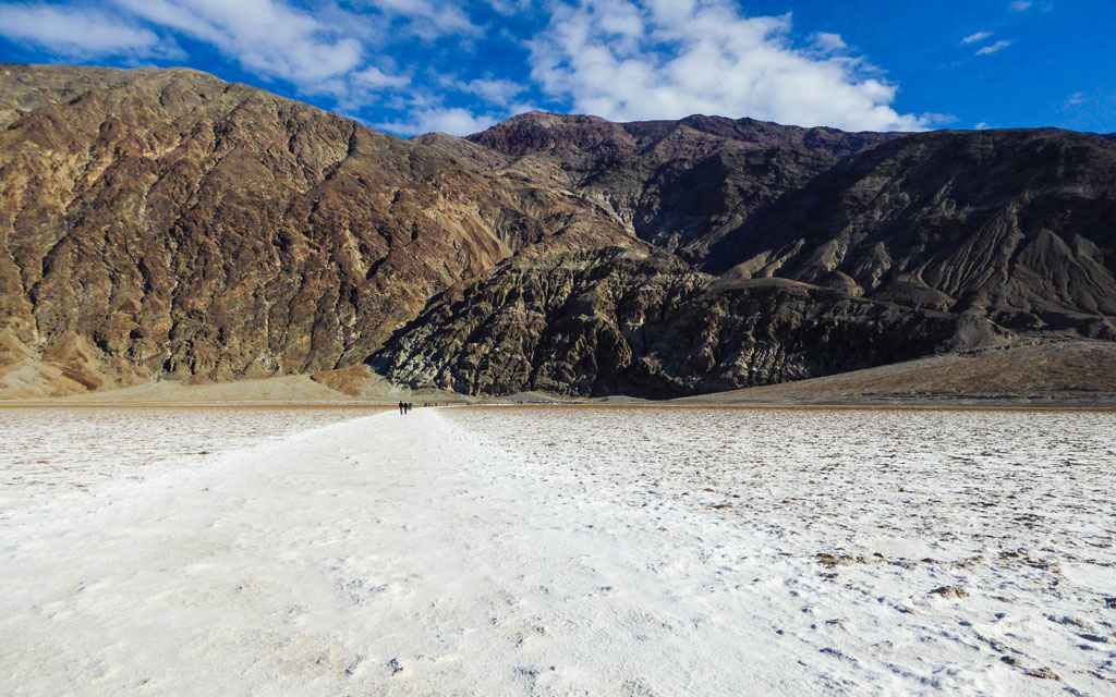
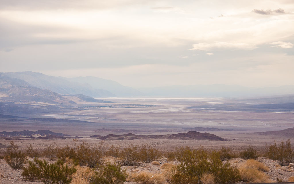
 After Salt Creek we continued south to the lowest point in North America, Badwater Basin, point "R" on the map. No Badwater is not the southern end of Death Valley, just the south end of this particular map. Badwater basin is 282 feet below sea level. An expansive salt flat, devoid of obvious life, and with distant desert mountains. It is called "Badwater" because people cannot drink the water. The natural pool of undrinkable water is because so much salt has built up from the basin.
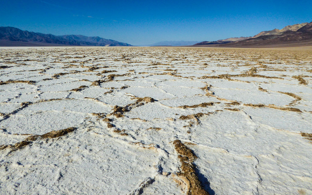
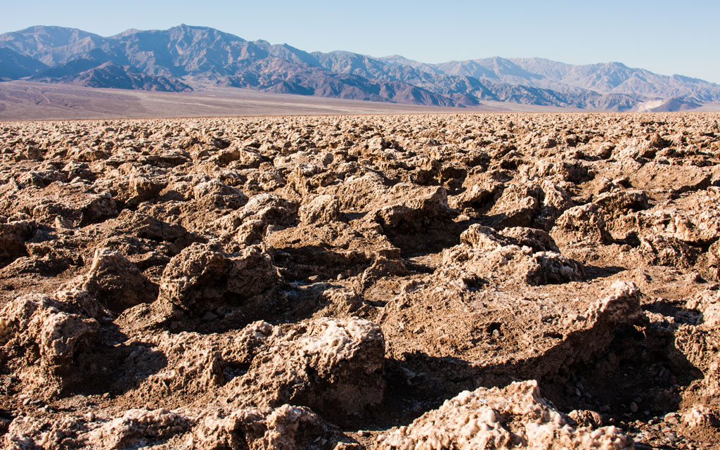 Next we drove back north to Devil's Golf Course, point "O" on the map. The Devil's Golf Course is a large salt pan on the floor of Death Valley. An immense area of rock salt eroded by wind and rain into jagged spires. So incredibly serrated that "only the devil could play golf on such rough links".
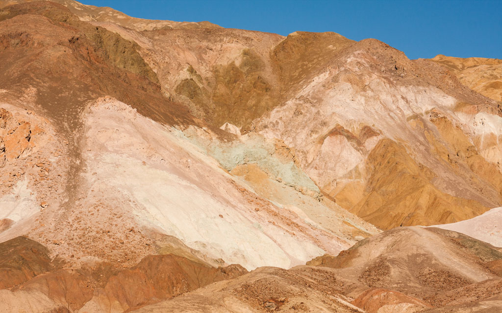
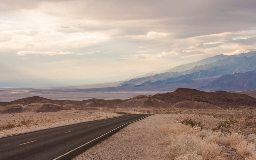
 Our final activity for the day was planned for the setting sun, the Artists Palette Drive, point "N" on the map. The Artist's Drive to Artist's Palette is a beautiful 9-mile drive that really showcases the splendor of the Amargosa Mountains. This paved road resembles a rollercoaster ride as there are many narrow winding twists and dips as the route cuts through the foothills.
This one-way road begins by ascending the mountainside, and you'll get some fantastic views of Badwater Basin as it gains elevation. Eventually the road levels off somewhat and then follows the contours of the mountain. There are plenty of places to pull off of the road to take in the scenery or snap a few photographs. The main point of interest on this drive is the Artist's Palette. This is a multicolored hillside where volcanic ash and minerals were deposited millions of years ago. Click here to see more of our Artists Palette Drive images.
By the time we finished the Artists Palette Drive our 2nd day was virtually over. On this day we had reservations at a lodge in Death Valley, Furnace Creek Ranch, near point "K" on the map.
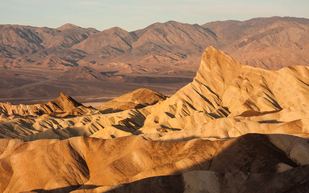
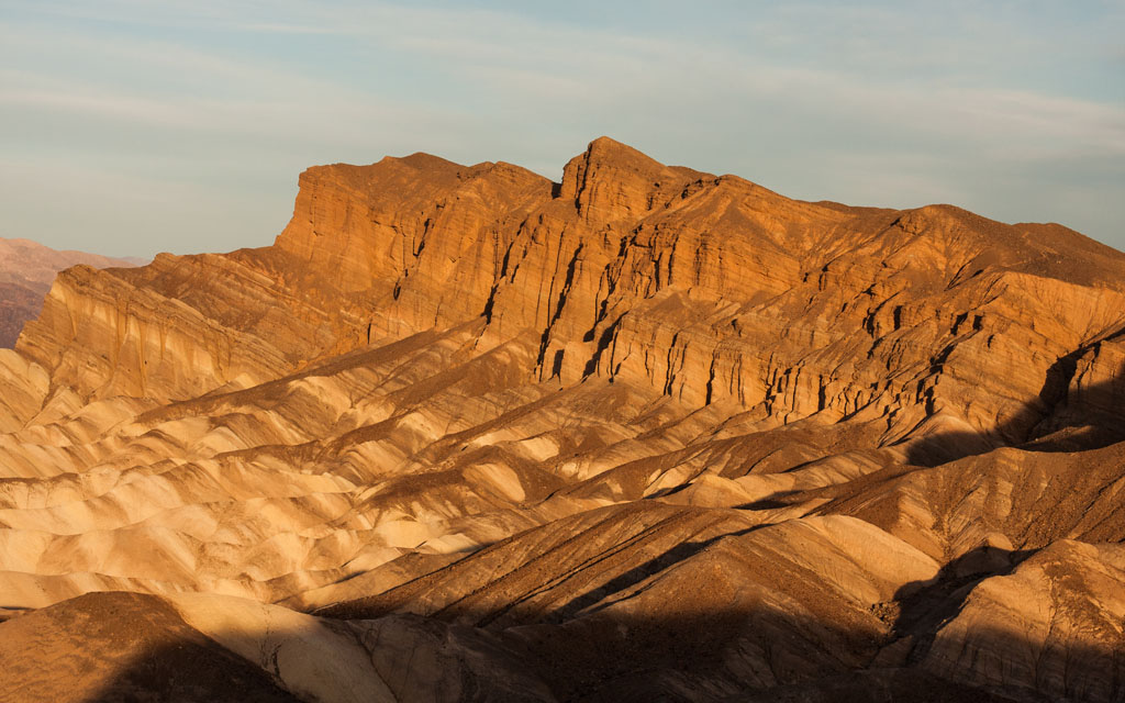 Day #3=>Our goal today was catch the morning light at Zabriskie Point, point "S" on the map. Although only a short distance from our lodge we were definately not the first there. Which was ok by me as it was cold. But actually our timing turned out to be perfect as the sun was just starting to appear on the peaks and valley below.
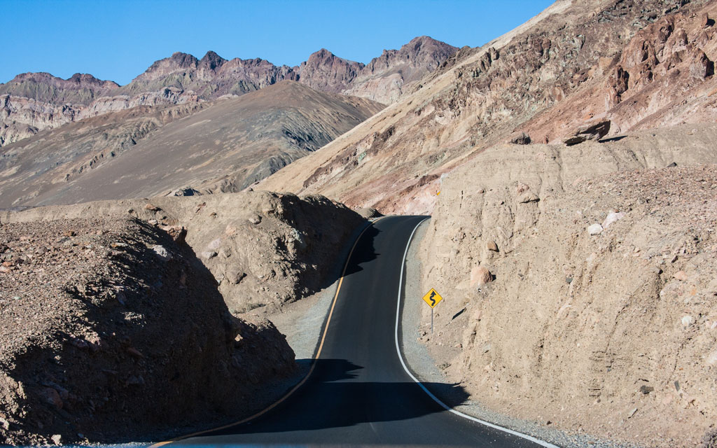
 After we continued on the same road to Dante's View, point "Q" on the map. If you look at the map you will see Dante's View a quite a distance off the main road. But it is all paved and a rather fun roller coaster type road in places. At the end of the road you are at a very high peak with stunning view and interestingly enough hiking opportunities as well.
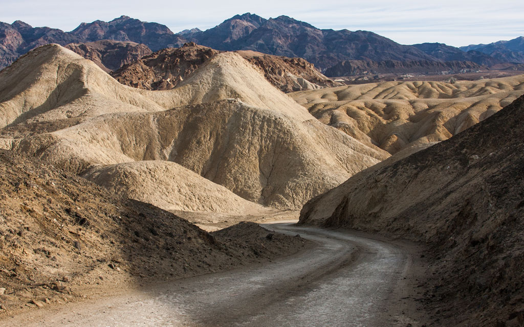 Next we headed back toward our lodge and took the Twenty Mule Team Canyon Road, point "M" on the map. This is a 2.8 mile, one-way unpaved road, narrow at places. An earthy colorfully place, the colors are similar to the ones on Zabriskie point but you are driving inside the path. There are scenes from Star Wars Episode VI: Return of the Jedi, filmed here.
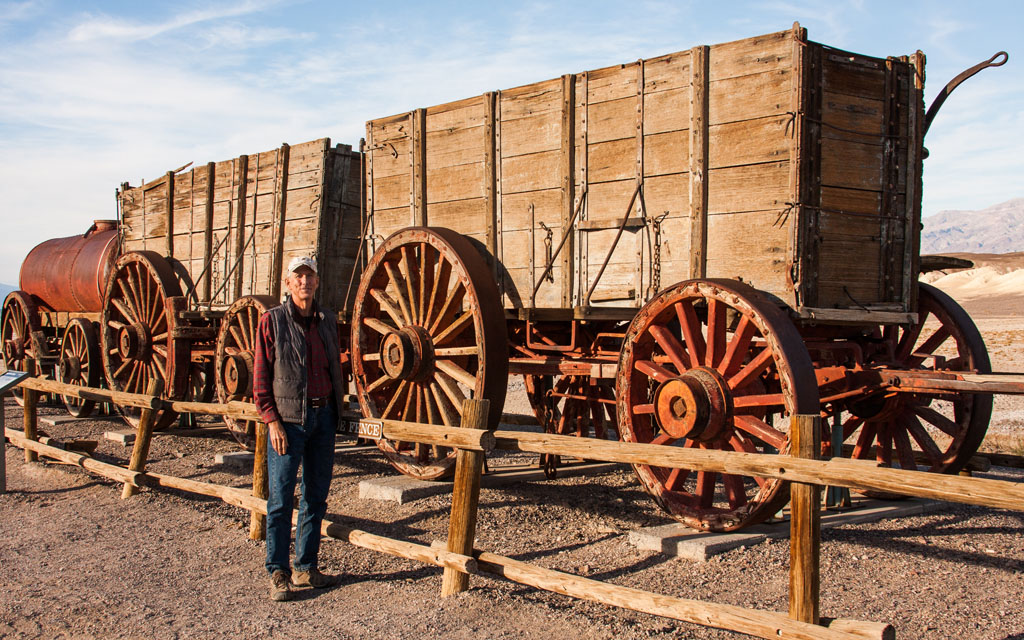
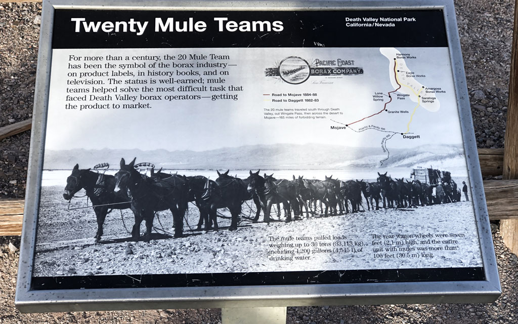 After the Twenty Mule Team Canyon Road we headed back to toward our lodge to catch a ranger talk at the Harmony Borax Works, point "K" on the map. This crumbling Death Valley mining complex was known for its use of giant, 20-mule wagon teams. The rear wagon wheels were 7 feet high, the entire wagon train weighted 36 tons, and was more that 100 feet long. It took a mule team 30 days to make the round trip to Mojave. Ironically this mill was only in operation from 1883 to 1889, but the 20 Mule Team was a symbol of the borax industry for more than a century. Click here to see more of our Harmony Borax Works images.
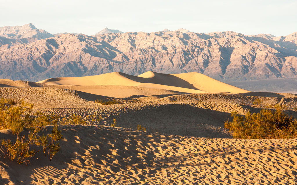 After the ranger talk, which very good, we headed to Mesquite Flat Sand Dunes, point "E" on the map. Our goal was to catch the setting sun on the dunes. As you can see very nice golden light and shadows. There was also a ranger talk here but we decided not to join and instead hiked the dunes by ourselves.
After our hike at the dunes, and the sun going down, day #4 was virtually done. We headed back to our lodge, Furnace Creek Ranch.
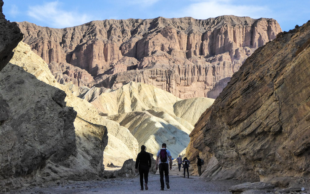
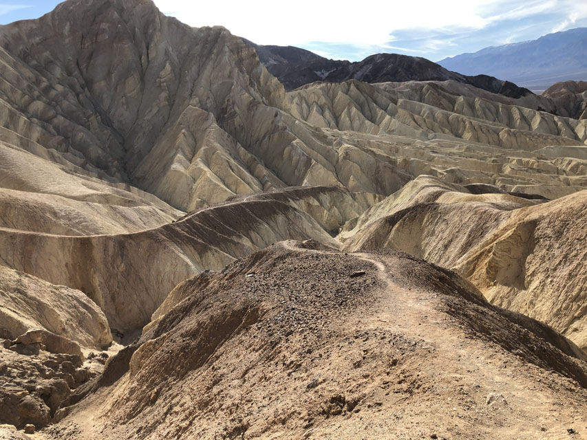 Day #5=>Today is our last day of this short Death Valley road trip. We decided to let it warm-up a bit before getting started and then went to the Golden Canyon trail, point "L" on the map. We took the Badlands Loop about a 2.7 mile hike through golden colored hills and winding narrow canyons. The sides of the canyon are made up of red mudstone and colorful mosaic conglomerates. Occasional broken pavement offers a reminder that a road once went through this canyon until a rainstorm took it out in 1976. We followed the main wash uphill toward the prominent landmark aptly named the Red Cathedral. The smaller image to the right is a view from the top/end of the trail. Click here to see more of our Golden Canyon images.
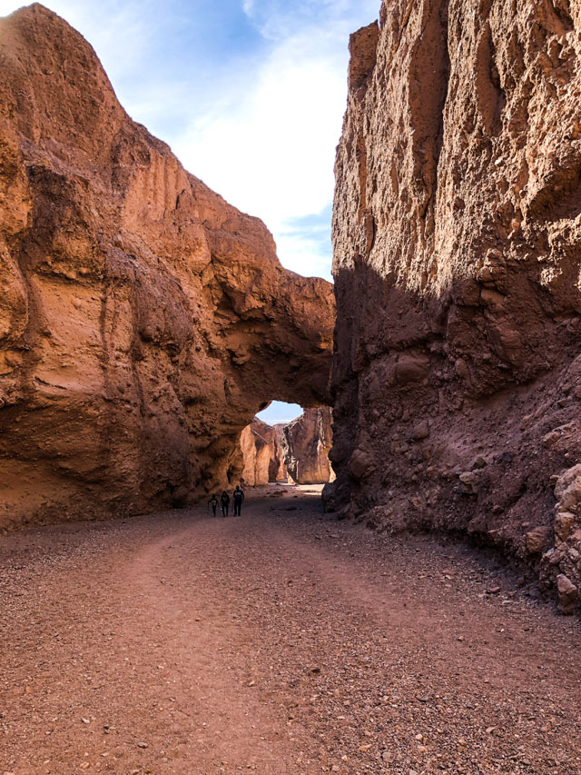
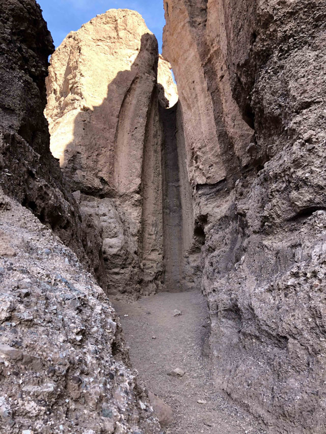 After the Golden Canyon hike we continue south on our way out of Death Valley but only after one more must see stop, The Natural Bridge, point "P" on the map. The full hike is 2 miles but it is a realtively short distance to get to the Natural Bridge. The canyon walls are narrow so this is a cooler hike but the colors are not as dramatic as the Golden Canyon.
 After our Natural Bridge hike we continued south on our way out of Death Valley. Before we totally left the park we had a short lunch stop, yes even MORE to see. Click here to see the rest of our Death Valley and Crater images.
Death Valley is DEFINATELY a do over trip for us!!!